


Organic Maps・Offline Map & GPS is an offline map and GPS navigation app for travel, hiking, trekking and cycling, built on OpenStreetMap data. It lets you plan, import and record routes, search for places and get voice-guided directions without an internet connection.
The developers describe it as volunteer-made, privacy-first and free, with unlimited map downloads and map updates every two weeks. The project is open source under the Apache-2.0 license, and the build on this page, version 2026.11.11-39-FDroid, is compiled by F-Droid from the published source code.
This article covers the features of Organic Maps・Offline Map & GPS, each permission it requests, how to install the APK, the one anti-feature F-Droid lists and who the app suits best.

What is Organic Maps・Offline Map & GPS?
Organic Maps・Offline Map & GPS is a map app that stores maps on your device. Once you download the regions you need, search, browsing and navigation all work without a data connection. The description says this saves mobile data and roaming fees and, with no background data transfers, helps the battery last longer.
The map data in Organic Maps・Offline Map & GPS comes from OpenStreetMap, a wiki-style world map built and maintained by volunteers. The app refreshes its data from OpenStreetMap every two weeks. If you notice something missing on the map, you can add it to OpenStreetMap and improve it for everyone.
Privacy is a stated goal. The developers say they do not collect any data or identifiers, and the app has no ads or noisy notifications. The developer on ApkSpark is listed as organicmaps.
The description on file for this release is cut off partway through its section on Wikipedia articles, so any features listed after that point are not covered here. Everything below comes from the part of the description that is available.
Key features of Organic Maps・Offline Map & GPS
- Fully offline use: Search and navigation work without an internet connection once maps are downloaded. You can explore and navigate while saving on mobile data and roaming fees, and the absence of background data transfers helps the battery last longer on long trips.
- Detailed, frequently updated maps: Maps are refreshed twice a month from OpenStreetMap. The description says they include building labels, benches, hiking paths and other useful details, and that volunteer mapping is often more accurate than commercial maps in less-mapped regions.
- Place search and details: Search by address, name or category and discover points of interest. Place pages can show opening hours, Wikipedia articles, wheelchair accessibility and other details that help you decide where to go before you set off.
- Turn-by-turn navigation: Organic Maps・Offline Map & GPS offers voice-guided, turn-by-turn directions for walking, hiking, cycling and driving. Routes can run between cities and countries and include multiple waypoints, and Android Auto is supported for use in the car.
- Hiking and cycling layers: Turn on special map layers to see popular hiking and cycling routes worldwide, sourced from OpenStreetMap. You can switch layers to show colored bike and MTB routes or official hiking paths, which helps when planning a day outdoors.
- 3D terrain and depths: See shaded relief, sea depths and detailed contour lines. You can tap anywhere on the map to see its elevation, which is useful for judging how hard a hike will be before you start walking.
- Public transport planning: Plan subway, light rail, bus and tram routes and see line numbers at stops. The description notes that live timetables are still in development, so planned trips are based on routes rather than real-time departures.
- Map styles: Choose a map layer that fits your activity, including Outdoors, Contour Lines, Hiking, Cycling and Metro/Subway. Switching styles changes what the map emphasizes without needing a separate app for each activity.
- Track recorder: Record, import, export and share routes and favorite places. The app supports KML, KMZ, GPX and GeoJSON files, so you can bring in tracks made elsewhere or share your own recordings with other tools.

Organic Maps・Offline Map & GPS permissions explained
Organic Maps・Offline Map & GPS requests thirteen permissions. Here is what each one does:
- Read storage: Reads files in shared storage, which fits importing KML, KMZ, GPX and GeoJSON files. This is sensitive.
- Approximate location: Reads the device's approximate location to show where you are on the map. This is sensitive.
- Precise location: Reads the device's precise GPS location, needed for turn-by-turn navigation and track recording. This is sensitive.
- Access location extra commands: Uses the "access location extra commands" permission, an extra control for the location system.
- Internet access: Connects to the internet, which the app needs to download maps and their updates.
- View network connections: Checks whether the device is online and which network type is used, for example before a map download.
- Prevent sleep: Keeps the device awake while a task runs, such as navigation or a map download.
- Run in the foreground: Keeps a visible notification while it works in the background.
- Background location service: Tracks location from a foreground service, which fits navigation and track recording with the screen off.
- Background playback service: Continues playing media from a foreground service, likely for voice guidance, though the facts do not say so directly.
- Background sync service: Syncs or transfers data from a foreground service, which fits map downloads.
- Show notifications: Shows notifications; Android 13 and newer ask first.
- Run at startup: Starts itself after the device boots.
On modern Android, sensitive permissions such as location and storage are requested at runtime, so you will see a prompt the first time Organic Maps・Offline Map & GPS needs them. You can allow precise location for navigation or choose approximate location, and change your choice later in system settings.

How to download and install Organic Maps・Offline Map & GPS APK
- Tap the Download button on this page.
- Allow installs from your browser when Android asks.
- Open the downloaded file.
- Tap Install.
- Open the app.
Our guide to installing APK files explains each Android prompt in more detail and covers common errors. The APK is 65.7 MB, and the maps themselves are downloaded separately inside Organic Maps・Offline Map & GPS, so download the regions you need over Wi-Fi before you leave.

Is Organic Maps・Offline Map & GPS safe?
Organic Maps・Offline Map & GPS is open source under the Apache-2.0 license. Its source code is public on GitHub, and bugs are tracked on the project's issue tracker. The official website has more about the project.
The APK comes from F-Droid. According to the repository note, F-Droid builds this APK from the published source code and signs it with the F-Droid key, and the file is downloaded from the official f-droid.org repository. The app's entry is on the F-Droid listing.
F-Droid lists one anti-feature for Organic Maps・Offline Map & GPS: NonFreeAssets, meaning it contains non-free media or assets. This label is about the license of some bundled files, such as media, not about tracking or ads. The code itself remains under Apache-2.0. If you only use software where every asset is freely licensed, take this into account.
On privacy, the developers say they collect no data or identifiers and show no ads. The app does request internet access, which it needs for map downloads and updates.
Organic Maps・Offline Map & GPS system requirements
- Minimum Android version: Android 5.0.
- Download size: 65.7 MB, plus the map regions you download.
- Supported ABIs: arm64-v8a, armeabi-v7a, x86 and x86_64.
- Version: 2026.11.11-39-FDroid.
- Release date: November 17, 2026.
Storage needed for maps depends on which regions you download and is not documented. A GPS receiver is needed for precise location and navigation. Android Auto support requires a compatible car setup.
Planning a hike with Organic Maps・Offline Map & GPS
A typical outdoor use of the app starts at home. Open the map, find the area you plan to visit and download that region over Wi-Fi. Once the map is on your phone, everything after this works offline.
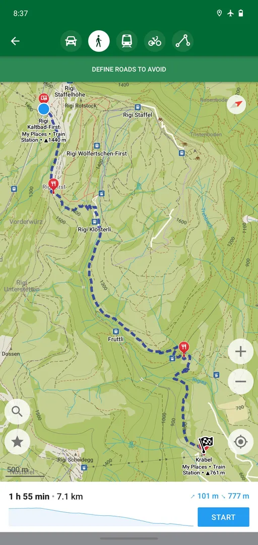
Next, switch to the Hiking map style or enable the hiking layer to see official hiking paths. Turn on contour lines and shaded relief to understand the terrain, and tap points along the route to check their elevation. Search by category to find places such as parking or points of interest near the start.
Create a walking or hiking route with waypoints and start voice-guided navigation when you set off. Start the track recorder too, so you have a record of where you went. Afterwards, export the track as GPX or KML to share it or to keep it with your other routes.
If you spot a missing bench or path along the way, you can add it to OpenStreetMap later. The change reaches Organic Maps・Offline Map & GPS through the regular map updates, which the description says happen every two weeks.
Using Organic Maps・Offline Map & GPS in the city
Organic Maps・Offline Map & GPS is not only for trails. In a city, search by address, name or category to find shops, restaurants and other places, then read their opening hours and accessibility details before going.
For getting around, plan subway, light rail, bus and tram routes and see line numbers at stops. The Metro/Subway style highlights those lines on the map. Live timetables are still in development, so check departure times from another source if you depend on a specific connection.
Driving routes work too, including longer trips. The description says routes can run between cities and countries, so the app can handle a road trip as well as a commute. Plan the full route at home with all your stops added as waypoints, then download every region it crosses so navigation keeps working at borders and in areas with poor coverage.
Once on the road, Organic Maps・Offline Map & GPS gives voice-guided, turn-by-turn directions. With Android Auto support, you can show navigation on a compatible car display.
Data, battery and privacy in Organic Maps・Offline Map & GPS
Three claims run through the description, and they are linked. The first is that the app works without a connection. Once you download a region, Organic Maps・Offline Map & GPS can search, show places and calculate routes on the device itself, so it does not need mobile data while you travel.
The second claim follows from the first. Because there are no background data transfers, the developers say your battery lasts much longer. A map app that is not constantly fetching tiles or sending location data has less work to do in the background.
The third is privacy. The developers say they do not collect any data or identifiers, which they connect to having no risk of data leaks and no ads or noisy notifications. The app does ask for internet access, but the description ties network use to map downloads and updates.
The description also states that zooming, search and route calculations are noticeably fast in Organic Maps・Offline Map & GPS. Speed is hard to judge from facts alone, so the best test is to install it and try a route in a region you know.
Contributing to the map behind Organic Maps・Offline Map & GPS
OpenStreetMap is a volunteer project, and the description invites you to take part. If a bench, path, building or shop is missing from the map in Organic Maps・Offline Map & GPS, you can add it to OpenStreetMap. Everyone who uses the map then benefits from the fix.
Your edit does not appear in the app instantly. Organic Maps・Offline Map & GPS pulls fresh data from OpenStreetMap every two weeks, so changes show up after the next map update reaches your downloaded regions. This rhythm is also why the maps stay current with real-world conditions such as new paths or closed shops.
The description says volunteer mapping is often more accurate than commercial maps in less-mapped regions, because the people who map an area tend to be locals who know it best.
Documented limitations of Organic Maps・Offline Map & GPS
- Live timetables not ready: Public transport routes and line numbers are shown, but live timetables are still in development.
- Maps must be downloaded first: Offline use depends on downloading regions in advance, which needs a connection and storage space.
- Non-free assets: F-Droid flags NonFreeAssets, so some bundled media or assets are not freely licensed.
- Incomplete description: The description on file stops partway through the Wikipedia section, so later features are not documented here.
Who should use Organic Maps・Offline Map & GPS?
Hikers, trekkers and cyclists are the main audience. Offline maps, hiking and cycling layers, contour lines and a track recorder cover what most people need on a trail where mobile coverage is weak or absent.
Travelers benefit as well. Downloading maps in advance avoids roaming fees, and the app's search and navigation still work abroad without data. Routes between countries and multiple waypoints help with longer trips.
Organic Maps・Offline Map & GPS also suits privacy-minded users. The developers say they collect no data or identifiers and show no ads. If you need live traffic or live transit times, note that the description does not mention traffic and says live timetables are still in development.
Tips for getting started with Organic Maps・Offline Map & GPS
- Download maps before you go: Get the regions you need over Wi-Fi so search and navigation work offline later.
- Pick the right map style: Switch between Outdoors, Contour Lines, Hiking, Cycling and Metro/Subway depending on your activity.
- Record your tracks: Use the track recorder on hikes and rides, then export routes as GPX, KML, KMZ or GeoJSON.
- Tap for elevation: Tap anywhere on the map to see its elevation when planning a climb.
- Use waypoints: Add multiple waypoints to a route for trips with several stops.
- Allow precise location: Grant precise location when asked so turn-by-turn navigation can follow you accurately.
Alternatives to Organic Maps・Offline Map & GPS
ApkSpark does not list related apps for this one yet. You can browse more Maps & Navigation apps to compare other map and navigation tools, or check the organicmaps developer page.
Final verdict
Organic Maps・Offline Map & GPS offers offline maps, search and voice-guided navigation built on OpenStreetMap, with hiking and cycling layers, terrain views, public transport planning and a track recorder. The maps update every two weeks and the developers say they collect no data.
It is open source under Apache-2.0 and built by F-Droid, with one NonFreeAssets anti-feature for some bundled media or assets. For hiking, cycling or travel without reliable data, Organic Maps・Offline Map & GPS is a strong pick.